Why do we teach Geography?
As geographers, our children will gain a depth and breadth of knowledge and understanding of the world, its environments and places both near and far, and the processes that create and affect them both human and physical. Our geography curriculum encourages children to appreciate and understand how the world works and the interconnections between communities and cultures as well as allowing them to consider how they can themselves be respectful, sensitive and accepting of the world.
We believe children are active participants and investigators within geography and value fieldwork as an essential part of the curriculum allowing them to explore, make connections and comparisons and identify patterns and changes. Geographical enquiry and skills are embedded throughout teaching to ensure skills are transferable and progressive. Our curriculum allows our children exposure to experiences they wouldn’t otherwise have access to in order to gain a greater understanding of the wider world through the use of primary sources such as field work and secondary sources such as digital and physical maps, atlases, globes photographs and books.
How do we teach Geography?
Teaching, learning and geographical enquiry is planned in line with the curriculum overview. Geography at St Silas is taught discretely over three half terms per year, however some units are double units to allow for depth and breadth of learning within that subject area.
In Key Stage 1 and Lower Key Stage 2, a two-year rolling programme is used to ensure children are learning a broad and balanced curriculum. Their learning may be based around stories linked to the geography topic.
Pupils are sat in mixed ability groups following our Cooperative Learning approach and to promote oracy. A variety of teaching approaches such as whole-class lessons, group, paired and individual work and discussions are experienced by pupils during their geography lessons.
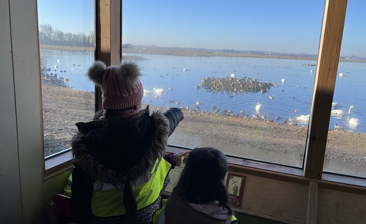
We believe fieldwork and educational visits help to promote learning in all aspects of geography and we aim to incorporate it in all areas of the curriculum. Each year group has the opportunity to make the most of our locality. In particular, children study at depth in our local area allowing
regular opportunities to explore the area they live and learn in. We also explore our local river - River Blakewater and visit our local coastal areas to compare and contrast with our local area.
How do we meet the needs of all children?
Where appropriate children will be identified to receive some pre-teaching of vocabulary and specific curriculum content at the discretion of the class teacher prior to a session so they are able to access the lesson. Geography is often a more ‘visual’ subject and we use this to the advantage of our pupils. Geographical texts and sources are differentiated where appropriate and where necessary will be introduced to the children at an earlier stage, allowing them to experience this before their peers and with adult support. We are an inclusive school
ensuring all children are included in the curriculum and any wider school activities. Each lesson will be recorded in various ways depending on the activity and will always take into account the child’s learning needs. For example, some children may be asked to write an explanation whereas others may be required to draw and label diagrams as a way of recording their learning. Children may work together to produce evidence of their learning and understanding, this provides opportunities for children to discuss and draw conclusions from evidence to find out about their past.
What do we teach?
St Silas has personalised the National Curriculum to make the most of our local area and to meet the needs of our children. For example local rivers are taught in Lower Key Stage 2.
In EYFS children access the local area producing messy maps and identifying places important to them. They learn basic geographical vocabulary through story and exploration. They use stories to learn about places around the world.
There are five important Geographical threads throughout our curriculum. These help the children learn through making connections. These threads are:
- Natural Environment
- Climate and weather
- Mapping
- Settlements
- Trade
There are opportunities across our curriculum to embed British Values and our own Key Values.
Geography
Knowledge Organisers for Geography across the school
Assessment
Geography learning objectives will be continually assessed by the teacher after each topic. These assessments will be used to inform future planning and will be passed onto the next class teacher for when the topic is revisited. This will ensure that skills and knowledge are embedded as part of the spiral curriculum.
Geography Subject Leader
Our Geography subject leader is Mrs Kurtis-White.
Support for Parents
DigiMap for Schools provides children the opportunity to explore OS maps both present day and historical for Great Britain and more recently the rest of the world, to learn about grid references and discover countries at street level. It is used within school for local studies and compare and contrast work. It is ideal for young minds discovering their environment and discussing topical events. Your child will be given a password to access this website from home. Take a look!
BBC Bitesize Primary
*click on the search bar and type in the name of your child’s topic or the area in which they are interested.

.jpg)
